Thursday, 19 December 2024
The best Byron Bay walks and hikes to go on this summer
by Rose White
Lace-up your boots and head out for a walk or hike to best appreciate Byron Bay.
The best Byron Bay walks and hikes are those that take in the spectacular scenery. From a dog-friendly beach to a legendary coastal path that squiggles along the craggy coastline to paths through photogenic pockets of rainforest, and a guided tour of a glow-worm tunnel, there are walks and hikes around Byron Bay designed to suit both casual walkers and serious hikers. We’ve done some of the hard work for you, rounding up some of the best spots to take a hike in Byron Bay and beyond.
Snap a selfie along the Cape Byron walking track
The 3.7-kilometre loop will reward you with spectacular views of the ocean and hinterland. (Image: Destination NSW)
Have you even been to Byron if you haven’t snapped a selfie in front of the iconic Cape Byron Lighthouse? You will find some of the best of what Byron has to offer along the 3.7-kilometre walk: from sun-drenched beaches to coastal rainforest and plenty of whales to spot when the season is right. There are also cafes along the way where you can stop and fuel up on pancakes and piccolos.
You can extend the walk – and burn off those calories – by starting at Clarke’s Beach, walking along the sand to The Pass, joining the Palm Valley track until you go over the cliffs to Wategos Beach before joining the track to the lighthouse. This is not a pram-friendly walk; there are a lot of stairs. While the road from Byron Bay runs right to the back of Wategos Beach, it can get very crowded and parking is extremely limited.
Take your pooch along for the Tallow Beach walk
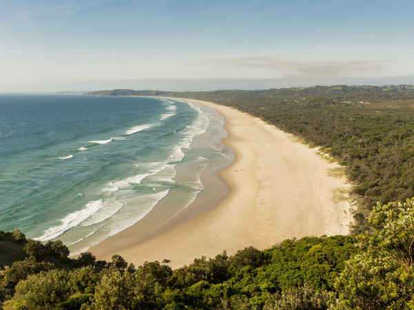
Tallow Beach extends to the Arawkal National Park. (Image: Destination NSW)
Slather yourself in 50-plus to walk to and fro along Tallow Beach, which curves for about seven kilometres between the Cape Byron Conservation Area and Broken Head Nature Reserve. The beach, just 3.2 kilometres from the heart of Byron Bay, is part of Arawkal National Park and one of the only places that matter when there’s big surf. In the early mornings, when the birds are singing, and the horizon looks as though it’s covered in a layer of gauze, you will see the ghostly silhouettes of fishermen casting their lines out to sea. The dog-friendly section of the beach stretches from a point adjacent to Jarman Street to the boundary of the national park.
Embark on the Three Sisters walking track
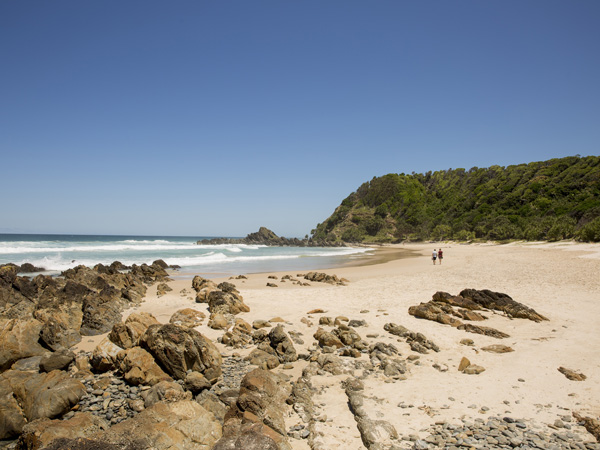
You’ll pass through the secluded Kings Beach along the Three Sisters Walking Track. (Image: Destination NSW)
The starting point for the Three Sisters Walking Track is at the southern end of the picnic area at Broken Head Nature Reserve. The easy 1.6-kilometre walk has gentle hills, and a few steps that will steer you through the emerald-green rainforest with carpets of moss to a lookout over Broken Head and the secluded Kings Beach. A quick heads up, though, Kings Beach is a clothing-optional affair. The area is rich in Indigenous history, which you can read about on the clearly signposted walk, which tells the story of the three sisters who were turned into rocky outcrops near the headland. In winter and spring, the walk offers great vantage points to spot whales and watch for white-bellied sea eagles spearing into the sea for food.
Visit a glow-worm tunnel in Nightcap National Park
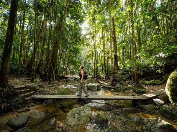
Tackle the tranquil rainforest trails in Nightcap National Park. (Image: Lismore City Council)
It’s not just the coastal walks that boast epic scenery around Byron Bay. Head to the hinterland and you will find a range of trails – from the tranquil to the well-trodden. The World-Heritage-listed Nightcap National Park is home to the distinctive curved silhouette of the ancient volcano, Wollumbin/Mount Warning, which rises above the landscape. Book a Hinterland Magic and Glow-worm Experience and you will be led to a tunnel lit up by the luminescent beetles. The tour also winds its way to a waterfall for a swim and to a rainforest temple hidden in the hinterland.
Look out over Lennox Head along the Coastal Recreation Walk
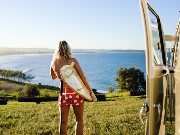
The popular surfing spot attracts many local surfers. (Image: The Legendary Pacific Coast)
Lennox Head is a 30-minute drive south from Byron and worth the detour to enjoy more great views of sky and sea. Do as Lennox locals do on the daily and walk to the top of Lennox Point, known locally as ‘The Point’. The path is very prominent as it hugs the coast and follows the shoreline. Head south, past groves of pandanus palms, until you reach Pat Morton Lookout, which passes the point break, where you will see talented local surfers all lined up waiting to conquer the next wave.
The views from the Lennox Head lookout span north across Lennox Head and Seven Mile Beach and south to Rocky Point and Boulders Beach and Skennars Head and, if you’re lucky, you might spot the resident dolphins who also like to surf the waves.
Minyon Falls Walking Track
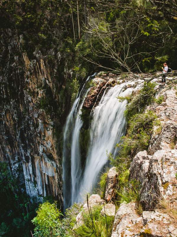
The 100-meter waterfall cascades over ancient rhyolite cliffs. (Image: Destination NSW)
Strike out beyond the well-worn tracks along the Byron Bay seafront to enjoy a glorious hinterland adventure along the Minyon Falls Walking Track. The path unfurls through the ancient emerald-green rainforest of Nightcap National Park until it reaches the lookout where you can peer over the top of the cliffs cloaked with Australian eucalyptus trees to see Minyon Falls tumble down into a beautiful natural swimming pool. A bit of rock-hopping is required to reach the base of the waterfall, which is most impressive after heavy rain.
Pinnacle Walk
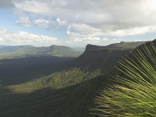
The Border Ranges can be seen from The Pinnacle lookout. (Image: Destination NSW)
The forested peak of Wollumbin can be glimpsed from plenty of vantages around Byron and the Tweed, but to really appreciate this ancient sentinel, take the Pinnacle Walk in the Border Ranges National Park. While keen hikers could once clamour to the summit, in recent years, the local Bundjalung people have closed this sacred site to tourists for safety and cultural conservation reasons. But you can still hike the foothills of this monolith and admire its majesty from the easy 600-metre return Pinnacle Walk and Lookout. Our hot tip is to rise before the sun to see Wollumbin emerge from the darkness.
Rocky Creek Dam
Pack your picnic basket for day at pretty Rocky Creek Dam, just a short side-step west of the Byron Shire. There are four walks to wander, ranging from the quick, 20-minute Water Dragon Walk to the 2-hour Scrub Turkey Walk, so you can pick the route that suits your group. Once you’ve absorbed your bush-hemmed surrounds and marvelled at the 14,000-mega-litres of water held by the dam, sprawl out in the picnic area and let the kids loose in the adventure playground.
Killen Falls
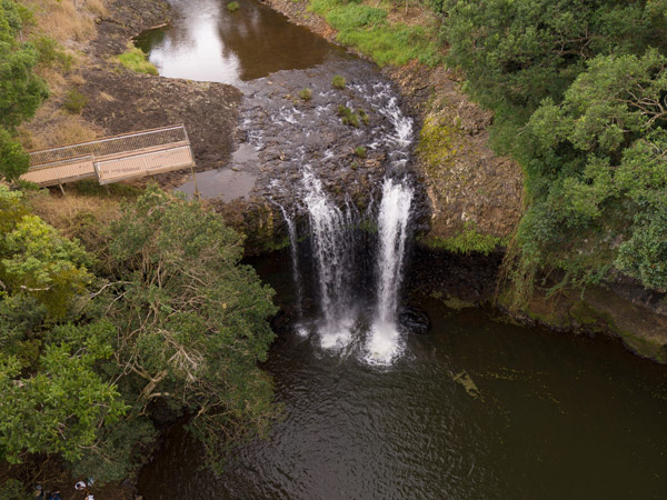
The waterfall is hidden in the hinterland between Byron Bay and Ballina. (Image: Destination NSW)
If you’d like to soak in some lost world magic, take a drive to Tintenbar. Tucked into the hinterland of the Ballina Shire, this serene and mostly secluded spot offers an easy 660-metre return walk to a viewing platform or a fairly steep 1-kilometre hike down to the base of the waterfall. Take a deep inhale as you tune into the mind-stilling sound of the thundering cascade.
Tyagarah Nature Reserve and Tea Tree Lakes
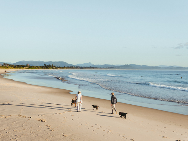
Go for a leisurely walk with your furry friends on Belongil Beach. (Image: Destination NSW)
Set between Byron and Brunswick Heads, Tyagarah Nature Reserve unfurls along a 7-kilometre stretch of sand. Behind the dunes, there are bush-hemmed tracks for proficient walkers, which take in tranquil tea tree lakes and a picnic area. If you’re eager to lace up for a longer hike, start the walk at Brunswick Heads and carry along to the north end of Byron at Belongil Beach. This 15.4-kilometre stretch will take a good few hours, so be prepared with water, food and sun protection, and don’t forget to tell someone where you’re headed.
Northern Rivers Rail Trail
For now, the quickly beloved Rail Trail kicks up the dust just north of Byron at Crabbes Creek, but planning is in the process to link the Tweed section to Byron and beyond. Until then, the current trail meanders beautifully through bucolic vistas, beneath rainforested canopies, and through former rail tunnels (one of which features a smattering of glow worms). While bikes are the most popular way to tackle the trail, you can also hike the full 24 kilometres or bite-size sections on foot. Just watch out for two-wheeled hoons!
Discover the best beaches in Byron Bay.
This article was originally written by Carla Grossetti with updates by Lara Picone.
The post The best Byron Bay walks and hikes to go on this summer appeared first on Australian Traveller.
